News Brief
U.S. Maps Untapped Hydropower Potential
The U.S. could double its hydropower production, according to a recent DOE study.
New maps show which streams and rivers have the highest generating capacity.Untapped Hydropower Potential
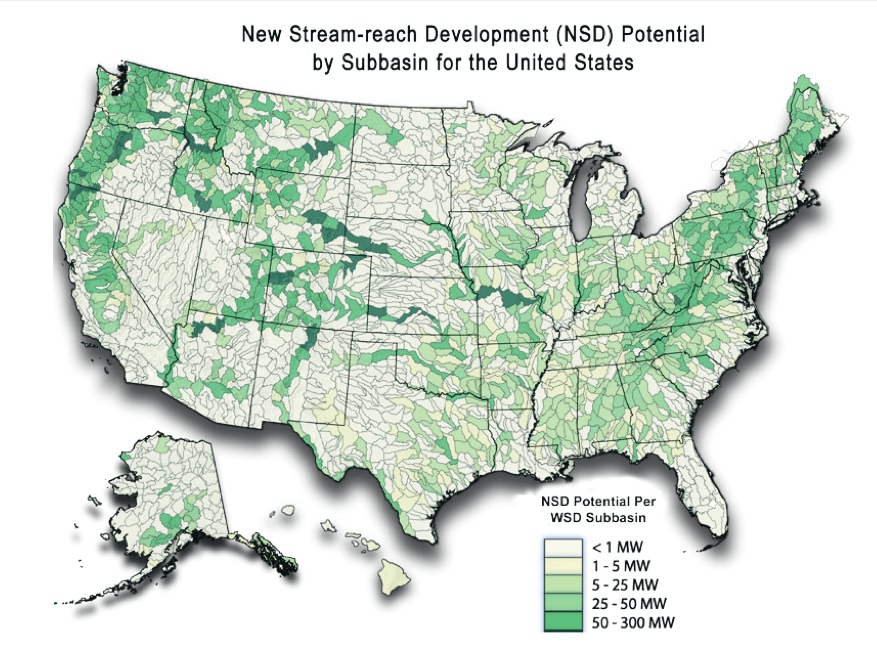
Untapped hydropower capacity totals 65 gigawatts in the U.S. if you discount federally protected areas like the Grand Canyon, according to the assessment. Colorado, Idaho, Montana, Oregon, and Washington have the highest potential, each with at least 3,300 megawatts of untapped potential. Although a DOE statement says the assessment “demonstrates one of the ways the United States can further diversify its energy portfolio” and advertises that a full build-out could nearly double hydropower’s 7% share of total U.S. electricity production, the study emphasizes the importance of the environmental attributes compiled alongside the energy-density data. In theory, this stream-specific information, which includes critical habitat, landscape disturbance, and water quality, will help energy developers avoid ecologically sensitive areas.
Datasets by region can be downloaded from the National Hydropower Asset Assessment Program website.
Published June 1, 2014 Permalink Citation
Pearson, C. (2014, June 1). U.S. Maps Untapped Hydropower Potential . Retrieved from https://www.buildinggreen.com/newsbrief/us-maps-untapped-hydropower-potential
Add new comment
To post a comment, you need to register for a BuildingGreen Basic membership (free) or login to your existing profile.